Archive for the ‘Uncategorized’ Category

Walking with Greg Giesekam and Lalitha Rajan on 5 June 2010

June 6, 2010

Beinn An Dothaidh

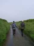
I am walking with Greg and Lalitha. I have known Greg since I was an undergraduate student (he was also my PhD  supervisor). I have known Lalitha, now Greg’s wife, from when we were postgraduates together.

 My 10th walk is the first one to take me up a Munro – Beinn An Dothaidh (Hill of the Scorching). Sitting on the edge of Rannoch Moor, it rises to 3293 feet. Greg walked this hill some 15 years ago, passing through and then looking down upon thick fog and cloud (which eventually evaporated). Today, it’s hot and sunny and I coat myself in Factor 50.

We begin our walk at the Bridge of Orchy train station and the route is well marked by a path that leads up the coire. At the start, a cheerful greeting made out of white stones laid on the ground welcomes us: ‘Hallo’, with a stone arrow helpfully pointing north (up the hill). The going is a steady ascent for the first section, not overly strenuous. It eases my legs and lungs into the concept of hill walking, warming them up, getting them into a rhythm. (Though I walk a lot, I do not walk up a lot of hills.) Looking back down the route just covered, even from here the view is something to behold, as the landscape opens up.

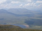
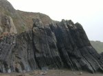
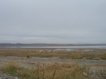
The ground is so dry in places it almost resembles sand. There are scatterings of wild mountain flowers, summery yellow and striking purple. The path gleams as the sun hits the surfaces of some of stones that seem almost metallic. Singular, huge boulders, presumably abandoned in the glacier melt, stud the hill side. Stopping for a rest and a snack, we enjoy the scene below, looking out across to Loch Tulle, my binoculars bringing the impressive Black Mount Lodge close.

Though there’s a sort of accepted etiquette to walking (saying hello to the people passing in the other direction), hill walking magnifies it for the passing is often an overtaking, as faster walkers stride ahead. But then at some point, they will stop for a rest, and you will in turn pass by them. And so this swapping of places will continue all the way up and down, forging a sort of camaraderie and temporary community of fellow walkers. Faces will become familiar, walking styles observable (look at the speed, look at the sure-footedness…)

As we walk further into the coire, a burn to our left cascades enticingly. Oh, to dip these hot feet into that cool water. At one point we cross it, and splash our faces, a momentary reprieve. During their ‘courtship’ Greg used to recite poetry to Lalitha when they walked in the hills. I’m impressed by that romantic gesture, though not surprised that Greg is a Romantic (he admits to bringing books of poetry with him on his walks; Walt Whitman was a favourite).

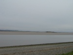
Soon, the Coire an Dothaidh becomes much steeper, and zig zagging, with high steps that make my thighs strain and my pulse race. The scree surface is pretty precarious in places, and even with the thankful loan of a walking pole, I find myself scrambling a bit. Finally, puffed, we’re at the top of the coire, the bealach, which is marked by a cairn. We have our lunch here, flanked on both sides (Beinn An Dothaidh on our left, and Beinn Dorain on our right), with a stunning view down to Loch Lyon. Though Beinn Dorain means Mountain of the Otter, Lalitha spots a huge hare, belting down Dothaidh and disappearing out of view up Dorain. Its winter coat still looks pretty intact. Patches of snow remain visible on the hill side.

This is not the summit of our walk though, just a temporary resting place. From here, the visible path continues fairly steeply up Dothaidh before petering out as the land turns boggy. The bogs provide perfect conditions for strikingly colourful mosses. One moss is almost black, as if charred. We head towards the ridge, on the way encountering a solid slab of snow, still more than a foot deep. (One can only imagine how deep it must have been in the winter.) It is creating its own wee stream of water, as the sun beats down on it. We dig into it, taking handfuls of mountain ice cream (totally low fat). The snow tastes startlingly cool, refreshing us for the last haul up the side of the hill. The grass here is dried out and yellowing (which explains the name of this mountain). 

Heading towards what Greg believes is the summit, I’m concerned as I can’t see a cairn marking it – could it be another trick of perspective? But reaching it, I find that I am, indeed, on top of the mountain. And on top the world. Standing on the plateau, we have a 360 degree vista. Though it’s a bit hazy, the view is breathtaking. In front of me, Rannoch Moor opens out, and mountain range after mountain range unfolds, all the way to Ben Nevis. It’s a view to soak up, to dwell on, to marvel at. This is why people climb hills. From up here, the hard effort makes full sense. ‘You can see why summits are known as the armchairs of the Gods’, says Greg.

It’s taken us four hours to get up here but it will take only two to walk back down. My ankles will begin to feel the pressure, Lalitha’s knees will throb, but we will be spurred on by the thought of a cool drink at the Orchy Hotel. Tomorrow, my legs will ache, a pleasant reminder of the heights they have carried me, of the priceless gift that walking (and friends) can deliver.

Walking with Mike Pearson and Heike Roms on 29 May 2010

June 3, 2010

Pembrokeshire Coastal Path

I am walking with Mike and Heike, friends made in the field of ‘performance’. Our paths have crossed for quite a few years now, though usually in the midst of conferences about history and live art, or performance and landscape.  I have also peviously walked as if I was Mike, retracing a performance of a guided tour he did around the village of his childhood (“Bubbling Tom”, Hibaldstow). I relish the prospect of walking with Mike this time.

Mike and Heike have booked us in to The Clock House, a lovely Guest House in Marloes (complete with a three course dinner that includes an offer of locally caught lobster). The aim is to reach their favourite place for walking: Skomer Island, which lies just off the Pembrokeshire Coast. It’s something of a bird watcher’s paradise (and Mike is something of a bird watcher. Though I own some binoculars, I’m not so great on identification.) The weather forecast predicted heavy rain and indeed, though I went to sleep in balmy, summery conditions, I am woken by the sound of a torrent. Rain is ok though – the wee boat to Skomer can cope with rain. It’s wind that’s the problem.

During breakfast the news is delivered that Kenny, the boat man, is unable to take day visitors over to Skomer today as the wind is picking up and we might get stranded there. Not getting to Skomer is something of a regular occurrence, and probably a large part of the island’s appeal. So I won’t get to experience Mike and Heike’s favourite walk after all; but curiously that seems appropriate. I appreciate the gesture of them wanting to share it with me. However, it remains their favourite walk, a walk they do together, and its being ‘off-limits’ to me seems almost poetic. The previous night, studying an aerial photograph, Mike gave me a virtual tour so I can, at least, imagine where the puffins nest.

By the time we’ve finished breakfast, the rain has stopped and we head out to walk their second favourite walk, for the most part following the glorious Pembrokeshire Coastal Path. A handy walking map, produced by The Clock House proprietors, Phil & Sue, guides us easily to the start of the walk, just behind the Guest House. Almost immediately, we are plunged into a verdant green canopy, and then onto a narrow, quiet county road, flanked on both sides by wild hedges, home to Whitethroats. Passing by a Youth Hostel, its roof made of lime (to prevent it from being blown off in the regularly high winds) we make our way to Marloes Mere, a marshland complete with handy bird hide. A brief stop here, spotting Little Grebe with even littler Grebe chicks, and the much maligned (common) Mallard.

Then back on to the road and heading West towards the coast. The sound of the sea, even from this distance, provides a constant background rumble. As we get nearer, we can see the waves breaking ferociously on the land’s edges. The steep path leads us down to Marloes Sands, a spectacular landscape whose geology feels almost prehistoric. Huge sheets of layered rock arranged at sharp angles provide a scale which makes me feel small. Heike takes a picture of us all, setting her new ‘retro’ camera on self-timer. (It’s the sort of camera that prompts her to come over all ‘Audrey Hepburn’.) Returning to the path, I manage to spot a bird; it’s hovering, so it doesn’t look like a gull. In fact, it turns out to be a Peregrine Falcon (having a bird watcher as a fellow walker is very useful). I feel proud of myself for spotting something (even if I could not have named it). It’s fitting that a Peregrine hovers above our peregrinations. A ‘resident’ breed to these parts, though, is the Chough. I’ve never seen Chough before, but put on the alert, I spot one, and then we see a fraternity ducking and diving beside the cliff, red legs and beaks separating them from crows. I can’t resist saying that I’m chuffed (corny though I know that is).

Continuing along the coastal path, and through a kissing gate (where a sign tells us that the sheep have learned how to open it), we see a Kestral, hovering, then swooping. It’s sunny, warm, but very windy. Reaching Deer Park, we head down to the inlet, Martin’s Haven, to use the public loos. Remarkably, these are the havens for nesting swallows too and they fly about our heads, quite untroubled by our presence. A welcome packed lunch is eaten, sitting in the bay (where the boat to Skomer is moored), and then back up to Deer Park (a deer wall was built in the eighteenth century, though deer were never actually introduced. Now, it’s home to wild ponies). Tramping through the vibrantly yellow gorse, we spot another breed of the area, the Stonechat. And on our way to the exposed headland, Wooltack Point, we see a single seal, and a single Gannet. At Wooltack Point, braving the strong headwinds,  we look across to Skomer Island, our shadow walk.

From here, we’re on the last leg of the walk, the start of which is a steep climb up a bank (like climbing a ladder, says Mike). The carpet of wildflowers on this walk has been memorable: bright yellow gorse, pink campion, fox gloves, pink clovers, large daisies, seas of bluebells: purples, whites, blues, pinks, yellows… The flora provides the foundations for fragile gossamer shelters too, spun by caterpillars biding their time till they transform into butterflies.

Walking high above Musselwick Sands, where the tide is out and we can see body boarders paddling in the sea, a bit of sand graffiti proclaims proudly ‘I love Dad’. A wooden sign informs us that we’re nearing the end (1 mile to Marloe), and it’s probably just as well, as our feet and legs are beginning to feel the 9 miles we’ve walked.

Back at The Clock House, I feel windswept and sun kissed and bank holiday blessed. All of me is utterly refreshed. The sensations of this land have impressed themselves upon me.

Pembrokeshire Coastal Path (and a bit extra)

Walking with Robert Thomson on 14 May 2010

May 20, 2010

Erith to Greenwich

I am walking with Robert, a friend from my student days (though Robert was a year above me). Robert is currently training for the Edinburgh marathon and has decided we should walk one of his running routes, which for the most part sticks close beside the Thames. If walked in full, it is 11 ¾ miles long. Robert, having checked Google, advises me that, based on average walk speeds, we should complete ours in just over 3 hours. This calculation, however, does not factor in the time it takes me to snap photos (in this case, a total of 70).

We arrive at Erith train station just after 4pm and walk down to the river. The tide is low, the mud flats exposed. Multiple signs warn of the dangers here – deep mud and strong currents. Numerous shopping trolleys and traffic cone are sinking slowly in the sludge. More picturesque are the slowly disintegrating wooden piers, testimony to other times and different river traffic. Not far along our walk, another accidental sculpture – a bail of squashed plastics, presumably heading for recycling, but somehow escaped the confines of its transporter boat and now nestling in the river edge’s wild flora. The fragments of plastic washed ashore all along the route, though like permanent confetti in their rainbow of colours, is quite devastating.

Aggregate factories with their huge mounds of material temporarily block our view of the Thames. I had no idea that aggregate would smell so strongly. Further along, we’re given a special sign (a good portent?) – a removal firm called Dee-Dee’s. And from here on to the sewage works where the smell is truly pungent – yes, it really does smell like shit. (Robert has not noticed it when he’s run here, so either he’s a very fast runner or the wind is blowing a different direction today.)

Information signs inform us of London’s sewage history, a history also written in the architecture before us, from the functional structures that resemble  modernism in their harsh practicality, to the beautiful Victorian buildings, all white, shiny tiles and classical aspirations encoded in pillars, to the gleaming, curvaceous new building that reminds me of the Museum of Modern Art in Bilbao. Robert, pointing to high rises in the shimmering distance, reassures me that we are getting nearer our destination. I worry, though, that this view is as deceptive as a mountain one; there’s always another peak to climb before you get to the top… A National Cycle Network Millennium sign helpfully tells us that it’s 1191 miles to Inverness, but ‘only’ 7 ¼ miles to Greenwich. Given that we’ve been walking for a fair old time by now, and that my feet are beginning to measure that time, we question the accuracy of the signs.

The route changes again as we pass through newly erected flats. For a Friday afternoon, which is periodically sunny, it’s very quiet. In a copse of trees Robert searches for the sapling transplanted from his own garden. The new spring foliage makes it impossible to locate, though he assures me that when he checked last month it was sprouting leaves and had settled into its new habitat.

The setting sun glances off the mud flats, turning them golden. Ducks hoover the expansive, wet muds in search of dinner. Our own – in Greenwich – is still a long way off. The Tate & Lyle factory sits iconically on the opposite bank. Planes landing at nearby City airport roar a short distance above us. No wonder there are spray painted protest signs on the walls and pavements nearby, resisting the airport expansion.

At Woolwich, the path heads inland, away from the river. Grabbing an opportunity for some much needed respite, we catch a bus at Warspite Road, alighting beside the newly developed Millennium Village (which in its ‘fun’ colours and shapes resembles a toy construction). On the beach, there’s a sculpture constructed from flotsam (it could easily pass for John Fox’s work – see 10th April walk). An unnoticed heron takes flight out of the manmade wildlife pond. The Millennium Dome is empty tonight, save for some geese waddling inside its perimeter fence. Anthony Gormley’s almost imperceptible man stands sentinel to the emptiness…

The most startling contrast of the entire walk lies just ahead, as on the other side of this Millennium Development are the undeveloped remains of the last century. We drift directly through the middle of an aggregate industrial site that lies entirely open to the walker. We could run in the pyramids of sand if we wanted. For a moment, I imagine myself in a James Bond movie, hiding from the ‘baddy’ and waiting for the right moment to squash him. It’s Friday night, though, so the site is entirely empty, no cranes are moving, no metal sparks from welders, no noise of any sort.

Another short detour alongside the motorway and finally we’ve reached a pub – the Cutty Sark, built in the mid-17th Century. We’re extremely weary travellers (I can hardly climb the wooden steps). It’s 8.30pm already (so much for 3 hours.) The lights on the high rises across the water sparkle. Battered fish, chips and peas, and a pint of lager shandy. A rest for these tired, throbbing feet. Then the last mile into Greenwich proper, the beautifully grand old naval college and observatory and our ultimate destination: the Cutty Sark itself, hidden behind a huge tarpaulin. ‘Should we hug or something?’, asks Robert. No wonder – it’s been such a long walk that it really does feel like we should be congratulating ourselves for having got to the end.

Walking with Rachel Jury on 9 May 2010

May 16, 2010


Vigeland Sculpture Park

I am walking with my partner, Rach. Rach has given it a lot of thought. Rather than walking a route that we’ve walked together before, that might hold some significance, or walking our almost weekly Sunday walk around the Botanic Garden and into Kelvingrove Park, Rach has decided that we should walk somewhere that’s new to both of us, a path that signifies the future. We celebrated our 15th Anniversary on May 5th. And Rach has decided that we should walk around the Vigeland sculpture park – in Oslo. This walk combines a number of our loves: being with each other, walking, parks, sculptures and weekends in European cities (usually birthday treats but 15 years deserves celebrating). Although it’s a new walk, it also cannily draws on our shared history; history and future, side by side.

The massive, beautiful wrought iron gates (art noveau?) mark our arrival at the park’s entrance. Apparently it is the most visited attraction in the city, and it’s certainly bustling on this almost-spring day, the sun burning through clouds intermittently. Before setting off, we prepare ourselves with a latte and mocha and shared muffin, sitting at an outside table in the park’s café. Rach is a bit taken aback by just how many people are flowing through the gates, and has a momentary wobble about her choice, wondering whether she should swap it. (In truth, we’ve already spent many glorious hours wandering Oslo’s glorious streets, exploring its galleries and ascending the daring architectural ‘walls’ of the new Opera – once in the morning and once late at night. Tomorrow will see us heading into the forests near Holmenkollen, where we will encounter deep snow hidden from the sun’s rays. The whole weekend is practically dedicated to walking, all of it memorable. Testimony to this fact is that, as our own shoes have begun to hurt us, today we decided to swap pairs. A symbol too, I’m sure.) I rather like the bustle of the park and the fact that these outdoor artworks are the city’s biggest draw. In the end, Rach reminds herself that the point of the walk is that it’s unknown, and it’s how we respond to it together, to whatever it throws at us or however it turns out, that’s important (it being a symbol of our future).  She needn’t have worried, of course, because it turns out to be a brilliant walk.

The 80 acre Vigeland Sculpture Park is home to 212 sculptures, all by Norwegian sculptor Gustav Vigeland (who died in 1943). Even more remarkable, every sculpture is of the naked human body (arranged singularly, in pairs, or in groups). The majority figure human relationships (lovers, mothers and children, fathers and children, elderly figures alongside younger ones, groups of young people, groups of older people). A few depict subjects on their own. The figures are all solid, enduring (built like me, Rach proposes, the women with sturdy legs and broad shoulders). The first set line the bridge (58 of them in total). Real people stand beside their counterparts, relations beside relations, resonating against each other. Walking towards the sculpture of a woman holding a small child at arms length is a man with a small boy atop his shoulders. Rach and I deliberately pose in front of the sculpture of two women, proudly claiming our dopplegangers. The figure of a bawling, hot-headed baby is counter-pointed by the live shrieks of excited kids. Rach’s favourite work is the one with a man besieged by a pack of toddlers, who hold on to him like little devils despite his best efforts to shake them loose. It’s clear where the power lies. It’s no surprise this is Rach’s favourite either, since it flies in the face of the usual depictions of children (as cute, adorable, etc.)

The bridge leads to the fountain, a huge bowl of brimming water upheld by swarthy men, the water seemingly irrigating a forest scene around the edges, more carefree people frolicking in the trees’ foliage and canopy (these sculptures all green rather than grey). From the fountain (of life?), we head up a grand staircase and through more iron gates, these ones depicting people, some women only, others men only. The steps lead to a huge, phallic monolith, itself made of more than a hundred figures, entwined, piled up, snaking to the top. It feels a rather macabre tower. I’m unsure whether it’s progress or repression; limbs entwined in love or battle. The works arranged around the tower do not make it any clearer, numerous tableaux depicting more scenes of human relationships, not many of them joyous but some tender (a daughter holding the head of a much older woman, her mother perhaps, their roles reversed as their lives progress?) My favourite of the park is here: two women, of similar ages, sitting close, comfortable, protective, voluptuous.

The top of the plateau affords something of a bird’s eye view of the park below, and only at this height can we see how beautifully it’s been laid out, with the wide, symmetrical avenues that lead us to this point reflected in the wide, tree lined avenues that cut the vast park up into different routes.

Following one of the paths through the park, we arrive at what seems to be a specially designated doggy park – a place in the park where dogs can be let off their leads to play with each other and run free. Rach wonders why they don’t run beyond the apparently unmarked boundary – there’s no fence to keep them in; it’s not really an enclosure. We make our way back round to the bridge to visit the final arrangement, a gaggle of babies, each atop its own plinth, in baby pose, variously grinning or girning.

From here, strolling around the edge of the lake, we fortuitously stumble across a pub which serves a welcome burger (for Rach), a mixed platter of savoury treats (for me), and a refreshing pint each – much needed sustenance after a couple of hours of tramping. Filled up once more, we’re back on the park’s paths, promenading its huge, majestic avenues. Rach knows I like the particular comfort that parks provide – routes to walk and explore without the anxiety of getting lost. The paths are line features, providing certain bearings even in ufamiliar environments. We are guided into our future.

Walking with Stewart Heddon on 3 May 2010

May 5, 2010

Sandbank to the Camel’s Hump

I am walking with my brother, Stewart. It seems appropriate that this walk with my big brother (a whole three years older than me) begins where the one I did with his kids ended. Rachael, Ryan and I walked from Dunoon to Sandbank. Stew and I set off from his home in Sandbank to walk the Ardnadam Heritage Trail. It will serve as a reminder not to overlook what’s in your backyard.

The start of the Ardnadam Trail is a few hundred metres from Stew’s front door, yet as we arrive there he admits that he’s never actually walked the whole route – a 2-mile trek that leads to the top of the Camel’s Hump (so-called for obvious reasons). The fact that he’s never walked it is his impetus for choosing it, and it’s a good choice. The weather is surprisingly nice for a bank holiday Monday – sunny and warm. Realising that we’re over dressed, we discard our outer coats. Before long, we come across the ancient site that has prompted the creation of this formalised ‘Heritage Trail’. There are the remains of an old round house (apparently). The signage that would instruct us on its history, and the history of the other stones sunk into the ground, has not fared as well as the ancient remains. Empty posts signal where the information boards should be. We’ll have to make up the history of this place ourselves, but we are no archaeologists. (A peek at the ‘Walk Highlands’ website, consulted after the walk, will inform me that: “The only structure visible to the layman are the scant remains of a chapel at just 1,000 years old. The site of an iron-age house, 2,000 years old, and a rectangular 5,000 year old neolithic house are marked out by short posts. There are several information boards giving information on the settlers who once lived here.”)

Next to the ancient sites, a bridge crosses a beautiful clear burn. Burns take me back to childhood, and therefore to some sense of ‘home’. I remember throwing leaves into clear water, seeing how fast they travelled. I remember looking for sticklebacks in the mud. I remember building dams. Though I’ve never walked this route before, it feels deeply nostalgic, a combination perhaps of the landscape (Argyll, woodland, bracken, moss, trodden foot path) and of the season (Spring – time to leave the cooped up house, the winter, to venture outdoors). The Primroses are in full bloom and as I stop to take a picture, I discover that both Stew and I associate Primroses with our mum. I think it’s to do with the short walk we used to make as children in Kilchrennan, from home to the shore of Loch Awe, a walk at this time of year which would be illustrated with Primroses, then Bluebells. Spring is emerging here, but only just. The leaves on the trees are beginning to unfold, each one a breathtaking origami of intricate, symmetrical creases. Amongst the mostly still dried and browned bracken, the odd precocious shoot of green. (Bracken breathes memories of dens and tics.)

We pass through old oakwood, juniper and gorse. It even smells of spring. Eventually, we hit the forestry commission plantation (spruces?), with its very different atmosphere. But forestry plantations hold memories for us too, which serves to give them some personality. Walking down the fire break we remember our dad being on fire watch over weekends in the summer, when we both absorbed the lessons unconsciously delivered: stupid buggers discarding matches in the forest, stupid buggers leaving glass bottles in the forest, stupid buggers throwing cigarette butts in the forest… Stew and I know the forest fire code pretty well.

We begin the ascent to the Camel’s Hump. It’s brisk, we’re breathless, but it’s also short. And below us, the view over Cowal, from the town centre to the end of the Holy Loch, over to Ardentinny and beyond. The depth of vision that attaches to this landscape is always breathtaking. It rolls back, mountain after mountain. Below me, at a more local scale, the new Grammar School’s unfamiliar shapes and surfaces overwrite one part of my visual memory bank. But other things fit fine – the hospital, the curve of the shore line, the playing fields, the ferry. Sitting in the sun (though it’s a bit cooler up here), eating our sandwiches, companionably sharing a Mars Bar (when did I last eat one of those?), we survey the view. It’s a lovely spot. And it’s literally on Stew’s doorstep.

For the route back, we look for the lower path – almost erased by the building of a new forest road (to allow access for felling). Stew is much better than me at reading the land and detects the old bridge, hidden in the greenery. This is a route little used and it feels all the more special for that. Walking behind Stew, as he leads the way, I’m struck by the fact that we very rarely spend time together, just the two of us. I’ve enjoyed this time, this walk.

Walking with Sharon Lancaster on 12 April 2010

April 14, 2010

Up Arthur’s Seat

I am walking with my friend Sharon. I’ve known Sharon since first year of university (1987). We met in our halls of residence (Wolfson Halls). Though she still lives only about ten minutes away, we’ve spent very little time together over the past few years, in spite of our repeated text-message pledges and best intentions to fix a date. Today, happily, we’ll succeed.

It’s another glorious morning that begins with a short, chat-filled train ride through to Edinburgh. Sharon has chosen Arthur’s Seat, an extinct volcano, for our walk. I feel as if I should have climbed Arthur’s Seat at least once before (surely?), but I actually don’t think I have. Standing close to the Parliament building, at the bottom of the Royal Mile, looking up at the hill ahead of us, it seems really remarkable that such a thing should exist inside a city. We admire it and then we wonder how we get up it. In the end, we ask a friendly (though armed) policeman for directions and he directs us towards an information board. As we get closer to the bottom of Arthur’s Seat it becomes apparent that we don’t really need directions because a) there are obvious paths scored into the hill side and b) the sunny weather has brought lots of people out. Though there are multiple paths trodden with the footfall of the undoubtedly millions of people who choose to climb this hill every day of the year, all paths eventually lead to the top.

The ascent becomes fairly steep fairly quickly and soon we’re both walking in t-shirts, a bit red in the face. I’m grateful that Sharon (ever prepared mum) had the foresight to bring suntan cream – Kids, Factor 50. The appeal of Arthur’s Seat is almost immediately apparent – turn around and just look at that view stretching out below us.  North to Leith and out on to the River Forth. Every step of the ascent adds another dimension to the view, the impetus to keep going up.

Before too long we stop for a breather. This is not a race to the top, after all. This is our day trip away. Sitting beside each other on a man-made step on the side of the hill, the sun on our faces, we close some of the gap of the past few years, chuntering away as if we’d only seen each other a few days ago. It’s like being 18 again. We’re in a world of our own, oblivious to the comings and goings that circle around Arthur’s Seat; there’s just us and the view.

Onwards, upwards, higher, a touch out of breath, a touch hotter and redder, a more inspiring view with each backward glance. Sharon says that if she lived in Edinburgh she’d climb up here every day. I wonder if people do. In the winter, or in the rain, it’s surely emptier? But the colony of people making their way up today lends it a holiday feel; lots of young children running excitedly (with the occasional daft jogger puncturing that sense of stepping outside of the everyday).

As we get even higher, the panorama unfolds on other sides than North. Our gaze follows the shore line towards North Berwick, Sharon’s childhood home. The last leg is a short steep climb – or a bit of scramble, it’s so eroded. The summit is marked by a trig point, and in fact the stones surrounding this are so polished by feet that they are impossibly slippery (as Sharon finds out). Having made it to the top, we decide to head down to a plateau below, on the south, to get a different view of the city. The ground is marked with stone graffiti (words spelt out using stones), the rather serious nationalist sentiment of ‘Freedom’, placed within a saltire, humorously undercut by the ‘Highland Fling’ close by. It’s not even noon yet, so we sit for a while on the short grass, basking in the sun, continuing to make up for lost time, a making up that probably relies more on our accounts of the daily than our tales of the dramatic.

Part of Sharon’s plans for the day (our ‘day package’) is some respite in that Edinburgh institution, the deli-restaurant Valvona and Crolla (a bit of effort rewarded by a lot of treat). Our descent takes us on a different, slightly boggier route and at the bottom we head in what we think is a Westerly direction, hoping that our instincts (or noses) will lead us to the pasta and white wine. Remarkably, it does (with a little help from a local). On the train home to Glasgow, we’re still a bit red in the face – a healthy combination, probably, of sun and refreshment.

To our shame, I must admit that neither Sharon nor I know why Arthur’s Seat is called Arthur’s Seat. Sharon, a primary teacher, promises to find out and let me know. And we both promise to get together again soon.

Walking with Gerry Harris on 10 April 2010

April 11, 2010

From Ulverston to Baycliff

I am walking with Gerry, whom I first met  in 1999, when she examined – and passed – my PhD.

Gerry meets me at Lancaster train station. We’re catching a train to Ulverston, where we’ll take a short bus ride and then walk along part of the Cumbria Coastal Path. Our destination is the Beach House of John Fox and Sue Gill, artists I admire greatly but have only met a couple of times. Deep in conversation on Platform 3, we fail to notice that the train we’re meant to be on has departed from Platform 2 – without us. An auspicious start to our walk (made somewhat ironic by the fact that part of our engaged discussion was about risk taking and travelling to unknown places).

But it’s a glorious day, we’ve got lots to talk about, so another 30 minute wait is not so bad. The train journey from Lancaster to Ulverston, when we do actually make it, is pretty spectacular, running alongside (treacherous) mudflats that seem to extend for miles, certainly as far as the eye can see. At one point, the train crosses an expansive bridge that cuts across the sand. Eating the packed lunches that Gerry has supplied (sandwiches always taste best when eaten on trains), the sun warming the Cumbrian coast, I really feel like I’m on holiday.

Alighting at Ulverston we follow Sue’s carefully provided directions that lead us into the town, where we catch a local bus and ask the driver to let us know when we reach the swimming pool. After a short while, the bus climbs its way up into a housing estate, zigzagging small suburban streets and then – stops. We’re the only ones left on the bus and at this point the driver admits that he’d forgotten all about is. (This local trip is turning into something of an adventure.) Never mind, he reassures us, he’ll be retracing his route in a moment and this time will make sure we’re safely dropped off. We sit at the front of the bus, just to be on the safe side.

Sue’s directions from the swimming pool: take the first left down a lane, then the first right, keep going till you reach the house called ‘Paradise’. Finally, we are actually walking, the sun on our backs. No traffic, curtains of tall corn stalks on my right, fields further afield. We walk for a bit on the road, finally coming to its end at the poetically named ‘Paradise’ (1 Priory Crossing,1882). From here we access the shore line – sandy, pebbly beach, the sea itself still a long way away. It’s easy walking underfoot and though the path is straight (I like coastal walks as it’s difficult to get lost) our convivial conversation meanders; we divert, loop, retrace, overtake. It seems wholly appropriate  that walking provides the perfect means to catch up with someone.

Passing through Bardsea (resisting the ice cream van but using the convenient ‘conveniences’) we continue round the coast till we come across evidence of beach-art activity – a bush decorated with flotsam and jetsam (mostly, to my despair, made of plastic, but at least it is being creatively recycled). A few more paces on, and there’s a beach garden, stones set in a circle, carved wooden oyster catchers flying on string from one tree to another. It would be hard to miss the home of Sue and John.

Up the path leading off the beach and into a garden packed with sculptures made from bits and bobs. In the circular studio on the left, we interrupt John, busy at work on his various pieces that engage with this particular environment (at present, pictures revealing the thousands of micro-organisms to be found in a bucket of sand from the beach below his home). Sue invites us in for a welcome cup of refreshing tea and some seasonal sustenance (toasted Hot Cross Buns and Simnel Cake). Their renovated beach house is carefully designed with lots of natural wood and glass, and curves that soften the square of windows in the living room. Looking out onto the expansive horizon (sky, sand and water), Gerry and I agree that if we lived here, that is all we would do. The landscape is so big and empty and riveting.

I tell Sue and John about 40 Walks and serendipity hovers again. Sue has given herself a couple of Birthday Walks too – including a long distance, week long walk alone for her 60th. Sue is a woman to admire.

John shares a picture book album that tells the story of Beach House. What is most evident is that its creation has depended on the continual efforts of family and friends. It is a feat of commitment, determination, community and love. We are also told about a likely wolf ghost (paw prints appearing mysteriously in the sand early one morning). Apparently, the last wolf in England was shot not too far from the beach house. It seems entirely likely that if the wolf is to return anywhere, then it will be here, close to the Fox’s home, where art and life are carefully synchronised.

My walk with Gerry, though only 3 ½ miles in length, was a day filled with different delights, including the accidents or ‘mistakes’. Though I’ve known Gerry since 1999 (when she examined my PhD) this is the first time we’ve actually been together totally outside the frame of our jobs. Gerry, one of the wise women I’m lucky enough to have in my life, of course chose our walk wisely too. Today, walking together not for work, not for research, but just for me, I really recognised the value of this birthday gift to myself, a gift that depends totally on the generosity of others.


Walking with Rachael and Ryan Heddon on 5 April 2010

April 11, 2010

Dunoon Pier to Sandbank

I am walking with my niece and nephew, Rachael and Ryan. They live in Dunoon (though Rachael’s studying at Dundee University at the moment). I used to live in Dunoon. My brother Stew still lives in Dunoon.

We’re going to walk from Dunoon Pier (where the ferry comes in) to Sandbank (where they live). We’ll follow the esplanade round. It’s about three and a half miles. The weather is a bit damp and grey, but not quite raining. Before setting off, we fuel up from the Italian restaurant (a new addition since my day). We’re the only ones in the place. Then a short walk along Argyll Street – Dunoon’s high street. As always, I point to the Argyll Hotel, the imposing building standing sentry at the town’s entrance, and remind Rach and Ryan that I used to work there (waitress and chambermaid). I’ve got lots of warm memories of that time: people I met and worked with, reckless older women (Arlene and Helen – in their early 20s!) who looked out for this young school girl. Rach tells me that she worked there too, but could only stick it for a day.

We drift along Argyll Street. Some shops have closed down or moved sites. The carcass of Woolworths has been taken over by a Woolworths lookalike. I’m glad the bookshop next door has managed to survive, though Ryan tells me it did close for a bit. Rach points out the Clansman – the pub where she and her mates go when they’re having a night out. I’ve never been in the Clansman. I moved away when I was 17 so I didn’t really have a local pub. But I did have the Blue Lagoon, a night club down on the front. We’d go there at the weekend, using our fake IDs and memorised invented birth dates to get past the bouncer, Snakey (though I’m sure he knew). There was also Pier 69, on Argyll Street itself, where my boyfriend Pat used to be the DJ. When he put on the last record, always a slow song, he’d leave his DJ booth and come down and dance with me.

I don’t come back to Dunoon very often and whenever I do I get a rush of nostalgia. Rach is 20 and I think it’s already nostalgic for her too. And maybe even for Ryan – nostalgia for the younger people we used to be, and for what this place was for those younger people (places for working out our teenage years, for hanging out, for hiding out, for finding out…) As we walk along the front, Ryan points to spots where he used to drink Cider, out of view from adults. Rach confirms that those were her spots too, though her tipple of choice was Vodka. There’s a Victorian shelter in a square patch of grass where she and her pals would hang out if they were skiving.

As we stroll along, spray from the rough, choppy water splashes over the railings. It’s always windy along here; invigorating and freezing. Rach tells me that on really blustery days, getting wet from waves would be a fun past time. Not one I ever indulged in.

At Kirn, I point out the small, square bungalow (like a matchbox), perched on the steep hillside, where we used to live (mum, dad, me, two brothers). 5 Cherry Hill. It was the first house my parents had ever bought (in their late-30s I guess). What seemed quite luxurious back then looks tiny now.

We pause to go into the coffee shop where Ryan works at weekends: 3 hot chocolates (1 with whipped cream, 2 with strawberry flavoured whipped cream, all with marshmallows). We’ve earned these warming drinks. Walking through Kirn, the number of boarded up, abandoned shops is striking. The ornate wrought iron Victorian street furniture tells of better fortunes, when Dunoon and its environs were filled with the bustle of day trippers, arriving by paddle steamer to escape the grime of an expanding, industrialised Glasgow.

At the bottom of the steep hill that leads, eventually, to Dunoon Grammar School (demolished and rebuilt over the past two years), is Kirn Church. I remind Rach and Ryan that this is where my mum’s funeral service was held in December 1986. They never met their grandmother, June, but they’ve heard tales of her. I don’t remember much about that day, other than it was a packed church, I chose to wear a bright green blouse, and after the service we had to travel by the wee ferry over to the crematorium in Greenock.

A bit further on, we reach the infamous Jim Crow – a large stone, shaped like a crow, that’s been painted to look like one too, and named ‘Jim Crow’. Rach tells me that plans to remove the paint (given the unavoidable racist connections), had been met with such vociferous resistance that Jim Crow was saved.

At Hunters Quay, we encounter a sign on a lamp post: appeals for a lost Chicken (scared by a dog). I wonder whether it’s a remnant from April Fools Day, but the same sign, posted on another lamppost a little further on, proposes that it’s sincere. We don’t encounter any chickens on the walk.

Stopping at what Ryan informs me is Lazaretto’s point, we read the history board that tells us about the men from Sandbank killed in WWI and WWII. Then we walk on into Sandbank itself, where another history board shows pictures of the village in the nineteenth century – complete with a paddle steamer on the Holy Loch. When I lived in Dunoon, the Holy Loch was dominated by the monstrous US Navy ship (thankfully now gone). The commissariat, a site of exotic Americana (because open only to the US workers), remains but is now a Marina shed.

Our arrival in Sandbank coincides with increasingly darkening skies. It’s been a good walk, a dry walk, a walk filled with memories for all of us. Some of those memories are shared across the generations (we’ve all sought shelter for illicit drinking) and also literally shared aloud with each other. I’ve enjoyed spending a few hours simply walking and talking with my niece and nephew, now both adults who have their own deep histories attached to this place, their home.

Walking with Eloise Godolphin on 21 February 2010

February 21, 2010

To Kelvingrove Museum

I am walking with my god daughter (or fairy daughter) Eloise. Elo is my youngest walking friend (3 and a bit). I didn’t know she was taking me on our walk today, so was delightedly surprised when she met me at the door of her home with her compass safely in its box. (There’s an uncanny, pleasing symmetry at work too: Elspeth was my first – and oldest – walking partner; Elo is my second – and youngest. Elo has chosen to walk with me on the 21 February; I walked with Elspeth on the 21 December.)

Today offered a beautiful, sunny, frosty, blue-sky morning. Perfect for our walk. Elo had long ago decided that she would take me to the Kelvingrove Museum. A particularly great choice for a Sunday. We walked with the compass in its box in the pocket of Elo’s red winter coat but stopped a lot to take it out and check our direction.

Up Great George Street, where we looked for my cat, Oko, but couldn’t find her. Onto Hillhead Street, and past Florentine House, where Elo’s mum and I used to study Theatre Studies together. Then past the bike shelter, where I pointed out my bike – locked there to keep it out of the rain. Then past the library – where me and her mum used to read our books on the top floor. And down the hill past the round reading room. The number 15 curiously sprayed onto the tarmac – captured in a photo taken by Elo. Another check of the compass, but Elo’s sure of the way and points across the road. And she’s right. A brown and white sign just ahead has an arrow pointing right too. At the bottom of the hill, a church, which Elo also rightly remembers is where I work.

Along Kelvin walk way, and Elo spots the shoots of some early spring flowers. The purple hint of a crocus. Another good photo opportunity. Then a scooter ride (wow – watch her go!) over the humps in the tar pushed up by the old roots of the avenue of trees that line the way like stately gentlemen from another time. Elo shows me a statue: a man in a seated position, looking very studious. It’s the King, she tells me. (I think it might be Lord Kelvin, but who am I to argue?)

Ahead, the red standstone of the museum, built in 1901 as part of the Glasgow International Exhibition. It glows orange in the bright sunlight. We scooter towards it – or rather, Elo scooters and I run, trying to keep pace. Then up the impressive stairs and through the huge, heavy doors and into – a world unto itself. It’s no wonder this is one of Elo’s favourite places. It’s bustling, but still has a sense of grandeur, of new marvels to be found with every visit, of unexpected corridors and sights suddenly coming in to view (brightly lit heads hanging in mid air, laughing; a spitfire flying over a herd of stuffed animals, all from different continents…) The best thing about Elo’s choice of walk is that it it doesn’t end outside; it continues in here.

She knows this place well and leads me, first, down to the ground  floor (stairs with two sets of banisters to accommodate the different heights of its visitors). We get the lift back up to the first floor, then take another set of stairs back down to the ground floor. Then the lift to the second floor, where we can peer through the marble banisters to look down onto a giraffe (Elo’s favourite), two elephants (one a baby), an ostrich, a kangaroo, a moose, an albatross, a seagull flying above us…  We need to get closer, Elo says, and she knows exactly how to get us down there. We turn into a long corridor, walk right to the end, turn left, and there the grand stairs are. We’re just in time for an RSPB-led wild walk too (all these walks!) – and I am stunned by the kids’ alertness to the fate of our planet. This awareness is surely a good sign? The oldest must be about 8 and her knowledge easily surpasses mine. But even the younger ones (4?) are able to give reasoned answers as to the benefit of the leather-backed turtle’s shell (‘it’s a home’). I learn from a  young boy (6?) that you can tell a monkey from an ape because monkeys have tails. He’s studying the rain forest in school, he tells us. “What should we do with plastic bags?”, the RSPB man asks: reuse, recycle, the kids say, with confidence. (I also learn that these bags are the cause of strangulation in the leather-back turtle population; they mistake them for jelly fish.)

The wild walking tour ends, and Elo leads me to the cafe for a well-earned, but fairly short rest. Then it’s off again (via a short detour to the gift shop to see what we can find for baby brother Hector for £1 – we find a snail whose tongue extends when you squeeze him. Perfect.) At the exit, we consult our compass again, determine that we need to head North East, and set off – on scooter – at a canter. Along Dumbarton Road, then right, past the hospital, and on to Byres Road. Elo is a Space Rocket. We stop to refuel a few times (both of us). We each have a key in our back which can be turned clockwise to replenish our energy sources. It’s very convenient as by now we’ve been walking for some hours. Whilst Elo fires off into space, I’m trying to fly like the Eagle we saw in the museum – though am informed that I’m not an Eagle but a Vampire. Then Elo becomes a dog – Ti Ti, and I become Scooby Doo. Luckily, I have a bouncy ball in my pocket, which I throw for Ti Ti. Ti Ti is a good dog and always brings the ball back to me and drops it into my hands. I throw and Ti Ti chases the yellow bouncy ball all the way home, barking loudly sometimes. We return hot, sweaty, thirsty and tired.

What a fantastic walk. And what a fantastic walking partner. It’s a very long time since I’ve been a Space Rocket, or an Eagle, or a Vampire, or Scooby Doo. I’d thoroughly recommend it.

Walking with Elspeth Owen on 21 December

December 24, 2009


Grantchester: Broadway to Cemetery

I am walking with the artist, Elspeth Owen, whom I met just last year. Elspeth is engaged in her own long-duration walking project, In the Dark (2-31 Dec 2009). December is a Blue Moon month (it has two moons). To mark this phenomenon, Elspeth (Material Woman) is remaining out of doors for the duration – finding shelter in a self-built hut, made from recycled materials already in her possession.

Each night, Elspeth walks on a radial path from her base, the radials forming a circle. For the first 14 nights, at a point on each of the radials, she buried a beaded necklace she had made. For the next 14 nights, she will retrieve them, one by one. This night, she is going out to find the 4th necklace. It is Winter Solstice, but in fact we don’t really talk much about that.

It has been snowing hard for some days. It is also minus degrees temperature. We walk out together just after 7pm. We each carry a large golfing umbrella. It is still snowing. We walk through the picture-postcard village of Grantchester, Elspeth’s home. Snow lies thick on the thatched roofs, as if it’s been carefully crafted on, for cinematic effect. We turn off Broadway at Coton Road, and follow this street for a few hundred metres, then take a left turn and walk down a lane. We notice immediately when the street lights end. It’s like crossing into another zone. The snow makes everything quiet, though there’s a distant, persistent hum of motorway traffic. The lights of cottages and farm houses twinkle warmly and I can’t help but think of Elspeth sleeping in her make-shift shelter which doesn’t look, to me, like it provides enough for these extreme conditions.

At the end of the track we cross into a field, following its perimeters. A couple of old, coppiced trees mark what would have been a boundary at some point. I am struck by how flat this landscape is. Coming from the West of Scotland, I am not used to this sort of horizon. It’s very open. I feel a bit at sea, without a bearing, nothing to locate me here.

Though it’s night its surprisingly light. We don’t need torches to find our way. It’s too cloudy to see the moon, but the snow acts as a reflector and there’s light pollution, presumably from Cambridge. The sky has an orange glow. The lights that reflect up from the motorway are like UFOs sneakily peeking over the edge of a bank.

We reach the edge of this field – we could be in the country – but then we cross a footbridge over the M11. Elspeth tells me the traffic is less than usual and slower moving. We continue walking, heading round another field and finally arrive at the cemetery. There are no churches or any buildings near it – only the road that is hidden partially behind an avenue of trees. It belongs to a church sited some distance away. The church doesn’t have any land nearby on which it could house its cemetery, so it acquired this plot.

Though Elspeth has passed this place many times in her car, she never knew the cemetery existed till she looked at the map in preparation for In the Dark. Her friend had arranged to walk with her one night, as part of the project, and Elspeth mentioned going to this cemetery. It turns out that her friend’s friend is buried here. It seemed fitting that this was where they should leave the necklace.

Elspeth refinds the grave stone easily, in spite of the dark and the weather. Anna May, 28th Oct ’41 – 25th April ’97. Much loved mother, wife and friend. In fact, it’s not a stone but a lovely piece of carved wood, made by Anna May’s son, in the shape of a house –  or a shelter – with a pitched roof. Elspeth tenderly digs up the necklace, itself sheltered behind the wood shelter, replacing the soil carefully.

We walk back the way we came, snow still falling. It is only about a 2 ½ mile round trip, but by the time we re-enter the village, with its orange street lamps, it feels like we’ve travelled much further.

It also feels like a privilege to begin my own walking project by participating – albeit momentarily – in Elspeth’s.

www.elspethowen.net/